 Burford Down group


|
Burford Down group
|
|
|
This location contains more than one megalithic monument, the individual sites are listed below.
OS Map Reference SX655587.
This site is in the county of Devon.
The nearest village is Harford.
The nearest town is Okehampton.
More details of this site can be seen at:
Follow the link to the web site where more details are available.....
OS Map Reference SX637601.
This site cannot be seen on the web....... yet. Mail us if you have a picture of this site.
OS Map Reference SX656588.
This site cannot be seen on the web....... yet. Mail us if you have a picture of this site.
OS Map Reference SX666612.
This site cannot be seen on the web....... yet. Mail us if you have a picture of this site.
OS Map Reference SX645602.
This site cannot be seen on the web....... yet. Mail us if you have a picture of this site.
OS Map Reference SX656594.
This site cannot be seen on the web....... yet. Mail us if you have a picture of this site.
OS Map Reference SX637601.
This site is in the county of Devon.
More details of this site can be seen at:
Follow the link to the web site where more details are available.....
OS Map Reference SX667613.
This site is in the county of Devon.
This site cannot be seen on the web....... yet. Mail us if you have a picture of this site.
OS Map Reference SX662609.
This site is in the county of Devon.
This site cannot be seen on the web....... yet. Mail us if you have a picture of this site.
OS Map Reference SX667612.
This site is in the county of Devon.
This site cannot be seen on the web....... yet. Mail us if you have a picture of this site.
OS Map Reference SX667612.
This site cannot be seen on the web....... yet. Mail us if you have a picture of this site.
OS Map Reference SX667612.
This site is in the county of Devon.
This site cannot be seen on the web....... yet. Mail us if you have a picture of this site.
OS Map Reference SX658608.
This site is in the county of Devon.
This site cannot be seen on the web....... yet. Mail us if you have a picture of this site.
OS Map Reference SX659605.
This site cannot be seen on the web....... yet. Mail us if you have a picture of this site.
OS Map Reference SX651599.
This site cannot be seen on the web....... yet. Mail us if you have a picture of this site.
OS Map Reference SX651598.
This site is in the county of Devon.
This site cannot be seen on the web....... yet. Mail us if you have a picture of this site.
OS Map Reference SX654610.
This site cannot be seen on the web....... yet. Mail us if you have a picture of this site.
OS Map Reference SX649610.
This site is in the county of Devon.
This site cannot be seen on the web....... yet. Mail us if you have a picture of this site.
OS Map Reference SX658600.
This site is in the county of Devon.
This site cannot be seen on the web....... yet. Mail us if you have a picture of this site.
Go back to map sheet SX.
Go back to the map of the British Isles.
Browse the list of stone circles and rows by name.
The data for these pages includes information kindly provided by Dr Aubrey Burl from the following books:
Stone Circles of the British Isles 1976,
A Guide to the Stone Circles of Britain and Ireland Yale University Press 1995,
From Carnac to Callanish : The Prehistoric Stone Rows and Avenues of Britain, Ireland and Brittany Yale University Press 1993.
Other recommended books...
The Megalith Map is brought to you by Andy and Alastair's Cheeseless ProductionsTM. This page published on 03/10/98 18:20:57.
 Myths and Megaliths
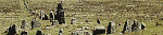 Prehistoric Circles and Rows